


Navionics Plus Regions South Marine and Lake Charts on SD/MSD
Customize
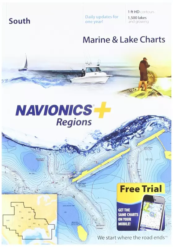
NAUS006R - U.S. South - Navionics+ Get the world’s No. 1 choice in marine mapping - with the best, most up-to-date Navionics+ cartography on your compatible chartplotter. For offshore or inland waters, this all-in-one solution offers detail-rich integrated mapping of coastal waters, lakes, rivers and more. Get SonarChart 1’ (0.5 meter) HD bathymetry maps, advanced features such as dock-to-dock route guidance technology, live mapping and Plotter Sync to provide wireless access to daily updates. The Navionics Chart Installer software also ensures the freshest chart data every time out. Navionics dock-to-dock route guidance solutions give you a suggested path to follow through channels, inlets, marina entrances and more. Multiple shading options aid in shallow water navigation and make it easy to highlight a target depth range for the best fishing spots. Chart Code - NAUS006R Coverage Area: Coverage of the lakes, rivers and coasts of Alabama, Arkansas, Florida, Georgia, Kansas, Louisiana, Mississippi, Missouri, Nebraska, New Mexico, Oklahoma, Tennessee, and Texas. Coastal coverage of the Gulf of Mexico, the Atlantic coasts of Florida and Georgia, the Bahamas and the Florida Keys are also included. Features: Nautical Chart – Comprehensive charts are derived from multiple officials, government, and private sources, displayed in a familiar look and feel SonarChart HD Bathymetry - Innovative 1' (0.5 m) bathymetry charts are created by using Navionics proprietary systems that augment existing content with sonar data contributed by the boating community Community Edits - Get useful local knowledge from edits made by users of the Navionics Boating app on your compatible smart device. Daily Updates - Up to 5,000 daily updates to our charts give you the most accurate, most current Navionics data available. 1 Dock-to-dock Route Guidance 2 - Start your trip with a suggested path. SonarChart Live Mapping - Watch new HD depth maps develop in real-time as your boat moves through the water. Advanced Map Options - Customize your view to focus on the details that matter most Plotter Sync 1 - Transfer routes and markers, update chart layers, and more - between your compatible chartplotter and the Boating app. Compatibility: Check the compatibility of Navionics+ content and features with your GPS chartplotter. Technical Specifications: Format - SD/MSD Card In the Box: SD/MSD Card 1 Subscription not required for SonarChart Live mapping feature on some chartplotter models; requires latest chartplotter firmware release. 2 Dock-to-dock Route Guidance is for planning purposes only and does not replace safe navigation operations. *Navionics+ and Platinum+ cards are not compatible with Garmin chartplotters. *Sold as an Individual This product may not be returned to the original point of purchase. Please contact the manufacturer directly with any issues or concerns. View detailed shorelines with marinas, docks and boat ramp locations. Increase your awareness of shallow waters and hazardous areas at any depth level including shoals, rocks, wrecks and more. Consult tides and currents. Fish smarter with up to 1 foot HD contours. You will find the best fishing spots with roadbeds, foundations, bridges, brush piles, culverts and creek channels. Enhance your favorite areas. SonarChartTM becomes more precise every day with sonar logs contributed by the Navionics Community from all major plotter/sonar brands and mobile devices. And with SonarChartTM Live, you can create real time personal 1 foot HD bathymetry maps on your plotter or mobile and upload sonar logs to Navionics. Navionics charts are updated with around 2,000 edits per day. You will have the latest Nautical Chart, SonarChartTM and Community Edits enriched with information from official sources, our own surveys and research, and contributions from fellow boaters. Additional features including Plotter Sync, Dock to dock Autorouting, SonarChart Live display on plotter and Advanced Map Options are available with select Raymarine models. Nautical Chart and SonarChart are preloaded and ready to use. Download daily chart updates and Community Edits for one year.
- Max detailed charts for cruising, fishing and sailing.
- Get full marine coverage out to Bimini and West End, plus more than 1,400 lakes in AL, AR, FL, GA, KS, LA, MO, MS, NE, NM, OK and TX.
- Includes SonarChartTM 1 foot HD bathymetry map that reflects ever changing conditions, and Community Edits, valuable local information added by millions of Navionics Boating app users.
- Get the most current charts every day with daily updates for one year.
Specifications:
| Materials & Construction | |
| Exterior | Machined |
| Product Details | |
| Model | MSD/NAV+SO |
| Sizing & Dimensions | |
| Height | 1 inches |
| Length | 1 inches |
| Product Dimensions | 1 x 0.1 x 1 inches |
| Weight | 0.16 ounces |
| Width | 0.1 inches |
| Technical Specifications | |
| Is Discontinued By Manufacturer | No |